 eAtlas Data Catalogue
Wet Tropics Management Authority
Type of resources
Topics
Contact for the resource
Provided by
Years
Formats
status
-
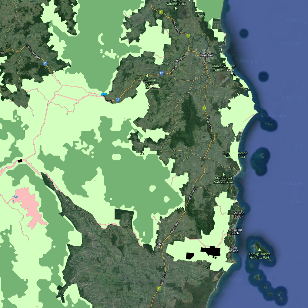
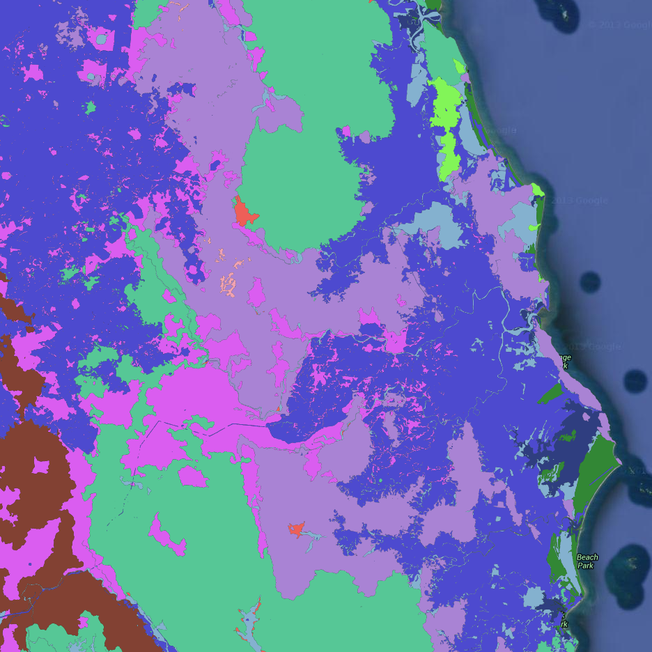
This dataset contains polygon features that represent the zoning classification of lands within the Wet Tropics World Heritage Area. This dataset is a working depiction only. For legal confirmation, refer to signed maps held at WTMA. The official zoning maps for the Wet Tropics of Queensland World Heritage Area can be downloaded from http://www.wettropics.gov.au/zoning-maps The zoning maps are an essential element of the Wet Tropics Management Plan 1998. The zoning maps depict four zones (A, B, C and D), based on distance from disturbance model and catering for community services infrastructure and developed visitor facilities. The zones have different degrees of integrity, different physical and social settings and different management purposes. The zoning scheme allows different types of activities in each zone, in accordance with the management intent and integrity of the zone. - Zone A: Land included in zone A has a high degree of integrity and is remote from the disturbances associated with modern technological society. - Zone B: High degree of ecological integrity and it is in a natural state but is not necessarily remote from disturbance. - Zone C: Land in zone C already contains disturbances, which are often associated with existing community infrastructure. - Zone D: Zone D contains lands where there are, or may be, visitor facilities of a well-developed type. For information about zoning see http://www.wettropics.gov.au/wha-zoning The Wet Tropics Management Plan 1998, including the zoning is currently under review http://www.wettropics.gov.au/wet-tropics-plan-review This metadata was prepared for the eAtlas and is not authoritative. Please contact the Wet Tropics Management Authority for an authoritative record.
-
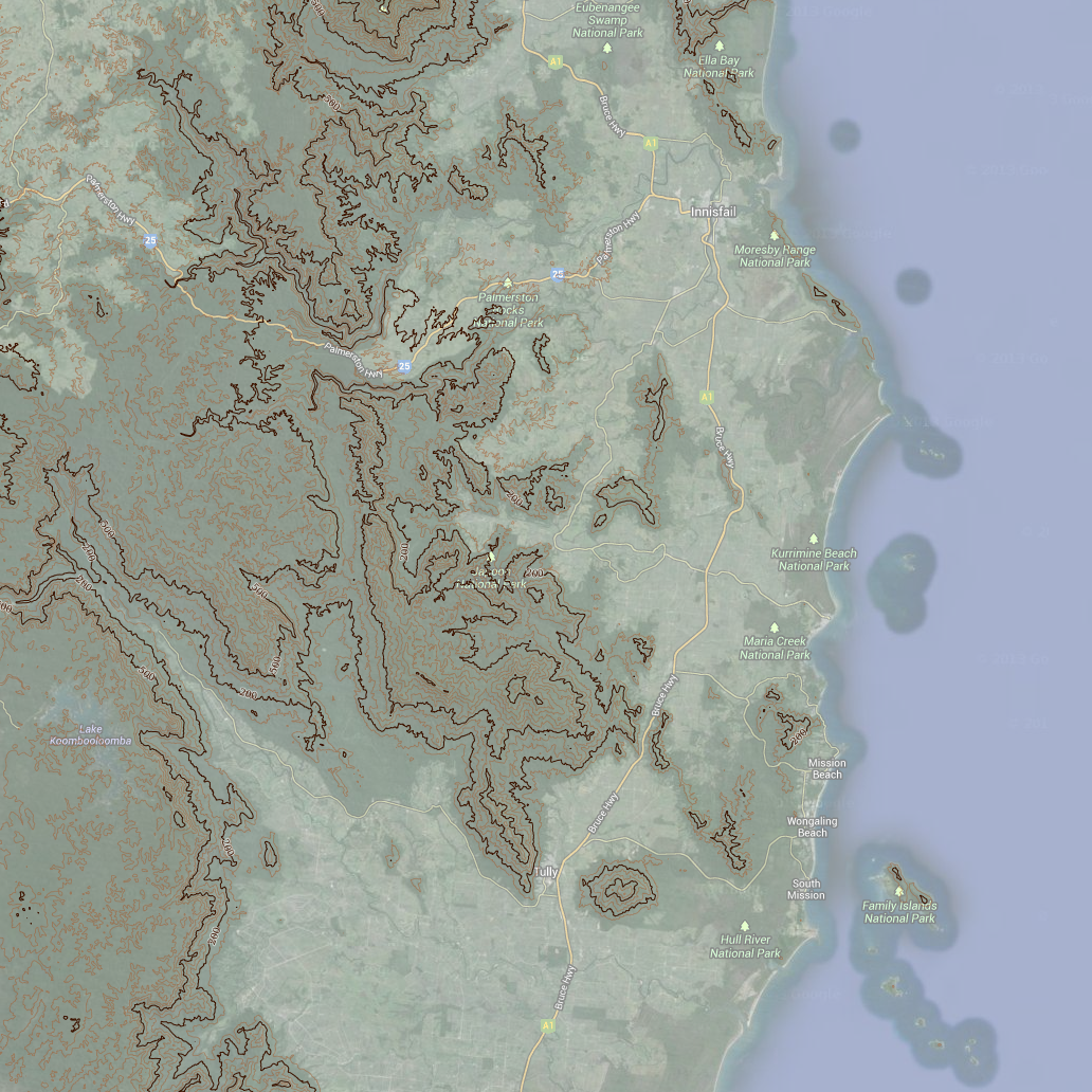
This dataset contains line and point features depicting contours across the Wet Tropics Bioregion as shown on the 1:50,000 scale National Topographic Maps. The dataset derives from Geoscience Australias 1:50,000 scale National Topographic Map Series data. Accuracy: Horizontal accuracy is at 90% of well-defined detail within +/- 25m of true position. Data reproduced with permission of Wet Tropics Management Authority. This metadata was prepared for the eAtlas and is not authoritative. Please contact the Wet Tropics Management Authority for an authoritative record.
-
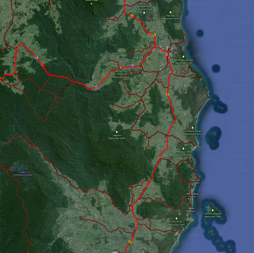
This dataset contains line features depicting road classification within the Wet Tropics World Heritage Area. There are five categories of roads in the Wet Tropics World Heritage Area roads where motor vehicle use is allowed by the public. These are as follows: 1. State-controlled road: roads which form part of the State’s road network. 2. Community access road: significant roads for local community transport. 3. Presentation road: roads which provide opportunities for presentation of the WHA 4. Presentation (restricted) road: presentation roads where a permit is required for use of a motor vehicle. 5. Management road: roads to provide access for management and research purposes. General public use of these roads is not considered appropriate. Refer to http://www.wettropics.gov.au/site/user-assets/docs/MotorVehicleAccess.pdf and http://www.wettropics.gov.au/site/user-assets/docs/s62_08motorvehiclesupdate.pdf for additional information. Wet Tropics road classifications only affect access by motorised vehicles. They do not affect access by mountain bike, horse or pedestrian traffic as these activities are not regulated under the Wet Tropics Management Plan 1998. However, other legislation may affect such use in the World Heritage Area. Roads which provide access to private land in the Wet Tropics World Heritage Area (defined as ‘lawful access roads’ under the Plan) are not depicted on these maps. The original information was derived primarily from 1:50,000 topographic maps. This was augmented using local knowledge and aerial photography. Main roads data was replaced using GPS fixed centrelines supplied by the Queensland Government. *Positional accuracy* Refer to source data as shown in attribute table. *Attribute accuracy* Attributes which are directly relevant to the Wet Tropics World Heritage Area have a 100% accuracy. These include information in the PlanClass98, Legend and InWha fields. The remaining fields - Source, Name, Standard, CurrentUse, Formation, WidthApprox - are indicative only. *Completeness* The dataset is complete within the World Heritage Area. An incomplete set of roads are shown outside the World Heritage Area. *Citation* Wet Tropics Management Authority (2013). Plan roads of the Wet Tropics Bioregion of Queensland. Wet Tropics Management Authority, Cairns. /Base data/Data reproduced with permission of Wet Tropics Management Authority/ This metadata was prepared for the eAtlas and is not authoritative. Please contact the Wet Tropics Management Authority for an authoritative record.
-
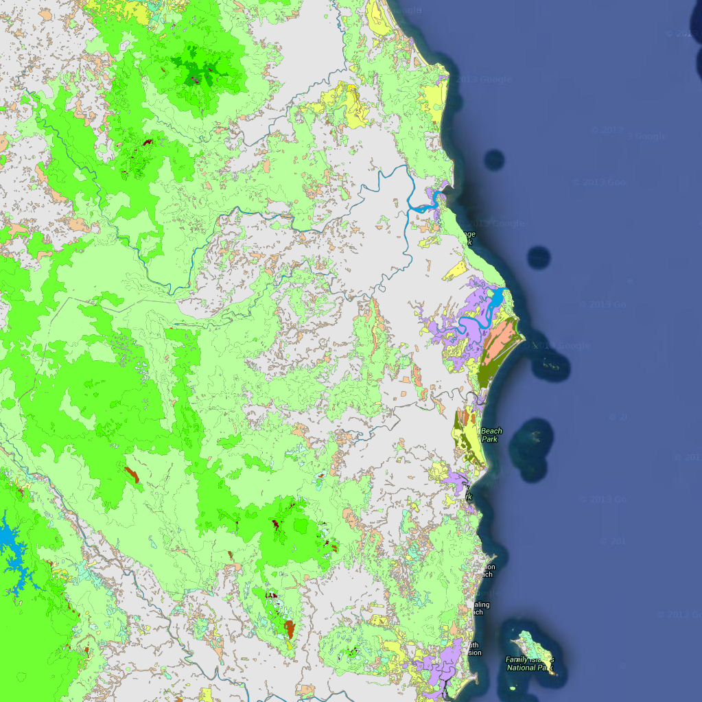
This dataset contains polygons depicting vegetation communities of the Wet Tropics Bioregion. Over 250 vegetation types are described using structural and floristic characteristics, and the vegetation communities have been classified using a logical, hierarchical framework. At a broad level, the vegetation includes the rainforests, forests and woodlands, sclerophyll rainforests, shrublands and heathlands, herblands and mangrove communities distributed throughout the bioregion. The dataset is derived from 1:25 000 stereo aerial photography. J.P. Stanton and D.J. Stanton delineated vegetation and geology types by manually interpreting and drawing polygons directly onto the aerial photography. The vegetation of the Wet Tropics Bioregion GIS dataset is also available to or those with ArcGIS capacity. Contact wettropics@wtma.qld.gov.au for more information. Attributes The vegetation has been classified into 5 levels, each of increasing level of detail. The following is the list of unique values for the first three levels. For the complete list of all 5 levels please refer to the 'Vegetation Levels 1 to 5 classification list' document. Level_1: * Vegetated, * Unvegetated Level_2: * Sclerophyll forests and woodlands, * Cleared, unvegetated or non-native * Rainforests * Mangroves * Non-woody vegetation * Shrublands and heathlands * Vegetation complexes and mosaics * Sclerophyll and sclerophyll rainforest transitions Level_3: * Eucalyptus forests and woodlands * Melaleuca forests and woodlands * Water bodies * Mesophyll rainforests * Mangrove forests * Mangrove grasslands and herblands * Rural, agricultural or urban areas * Grasslands * Shrublands and heathlands * Coastal beach complexes * Riparian complexes * Naturally unvegetated * Closed Acacia forests * Closed Eucalyptus forests * Acacia forests and woodlands * Microphyll thickets * Notophyll rainforests * Secondary successional complexes * Casuarina forests and woodlands * Sedgelands * Rock pavement and coastal headland complexes * Lophostemon forests and woodlands * Fern complexes * Microphyll rainforests * Palm-leaf rainforests * Wetland complexes * Syncarpia forests and woodlands * Notophyll thickets * Closed Lophostemon forests Positional accuracy The positional accuracy of the mapped vegetation polygons is ±12 metres from the true position as depicted on the Australian 1:50 000 Topographic Survey Map Series R733. Horizontal accuracy is estimated at 90% of well-defined detail within ±50 metres of true position. Attribute accuracy Attribute accuracy is estimated at 95%. Citation Wet Tropics Management Authority (2009). Vegetation Mapping of the Wet Tropics Bioregion of Queensland. Wet Tropics Management Authority, Cairns. Acknowledgements The expert assistance and advice of James Cook University and the Queensland Herbarium is gratefully acknowledged. /Base data/Data reproduced with permission of Wet Tropics Management Authority/ This metadata was prepared for the eAtlas and is not authoritative. Please contact the Wet Tropics Management Authority for an authoritative record.
-
This dataset contains polygons depicting geology as deliniated by botanist J.P.Stanton and geologist D.J.Stanton within the Wet Tropics bioregion. The geology mapping of the Wet Tropics Bioregion is based on interpretation of aerial photographs during WTMAs Vegetation of the Wet Tropics of Queensland bioregion mapping project. Aerial photography was also used to select sites and traverses for ground truthing work. The geological classification and boundaries were based on their relevence to vegetation patterns. The dataset has been derived from 1:25,000 aerial photography. Botanists J.P.Stanton and geologist D.J.Stanton deliniated vegetation and geology types by manually drawing polygons directly onto the aerial photography. Field verification was also undertaken. Aerial photographs were scanned and authorectified to WTMAs 50k river dataset using an 80m digital elevation model (DEM). Linework was extracted digitally from the rectified photography and attributes added manually. This dataset covers the entire Wet Tropics bioregion. *Positional accuracy* Accuracy is estimated at +/- 12m from true position as depicted on the Australian 1:50,000 Topographic Survey Map Series R733. *Attribute accuracy* Attribute accuracy is estimated at 95%. *Citation* Wet Tropics Management Authority (2013). Geology of the Wet Tropics Bioregion of Queensland. Wet Tropics Management Authority, Cairns. /Base data/Data reproduced with permission of Wet Tropics Management Authority/ This metadata was prepared for the eAtlas and is not authoritative. Please contact the Wet Tropics Management Authority for an authoritative record.
-
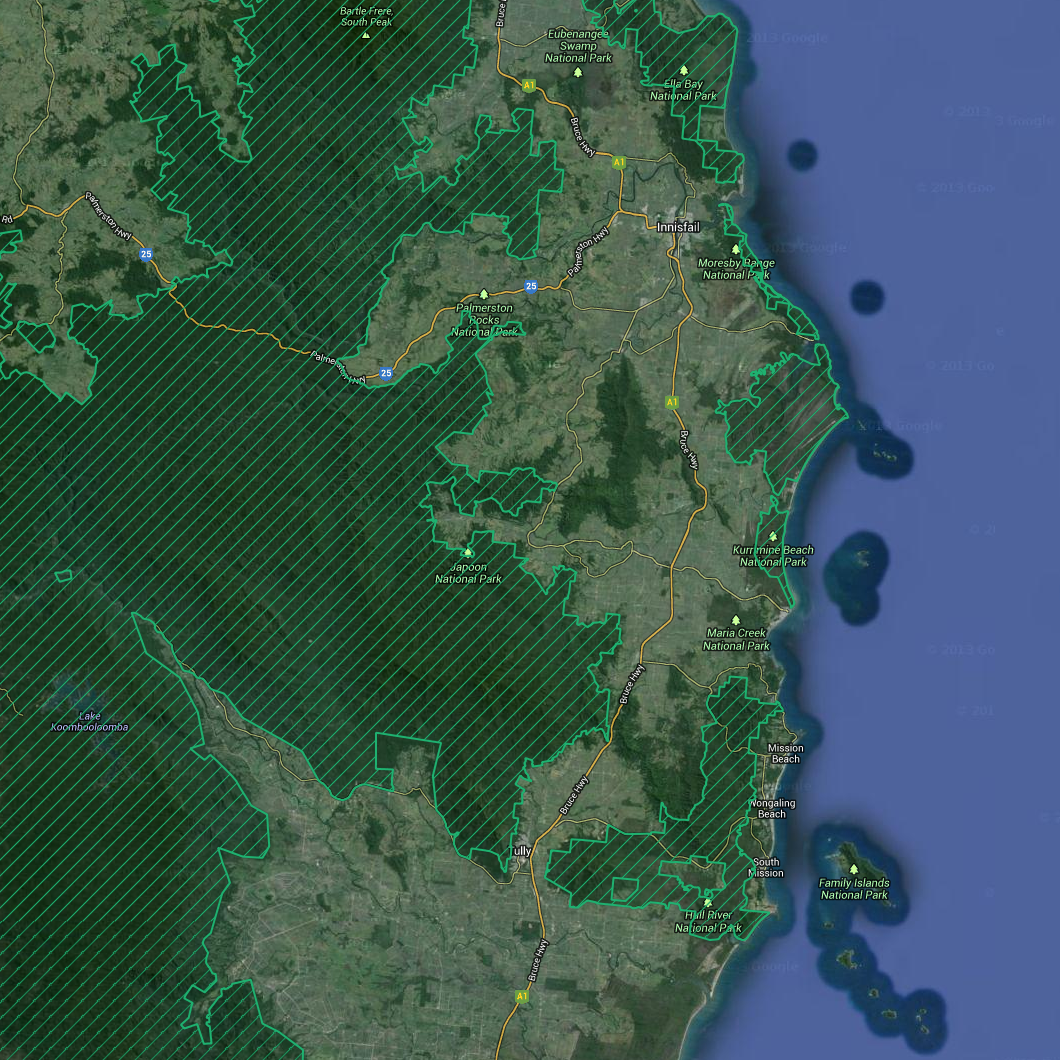
This dataset contains polygon features that represent the zoning classification of lands within the Wet Tropics World Heritage Area, according to the Wet Tropics Management Plan 1998. This dataset is a working depiction only. For legal confirmation, refer to signed maps held at WTMA. http://www.wettropics.gov.au/boundary-maps The World Heritage Area boundary is legally defined by Wet Tropics Management Authority (WTMA) WTQ1 SH1-32 series. (Note: Along the coastline, it shall be low water mark). These maps should be referred to for any legal purposes. This dataset is designed to show the intent of these plans relevant to the current Digital Cadastral Data Base (DCDB). Most lines are derived from DCDB, and other lines derived from 1:50,000 topographical data and other sources. *Accuracy* Lines derived from the DCDB were within 1m of the DCDB as at 29/11/2008. Lines that are not derived from the DCDB are approximate only. They were derived from topographic mapping originally, then adjusted to the DCDB in 2002, and then further adjusted as the DCDB was updated since then. For further information visit the Wet Tropics Management Authority http://www.wettropics.gov.au/legislation This metadata was prepared for the eAtlas and is not authoritative. Please contact the Wet Tropics Management Authority for an authoritative record.
-
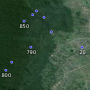
This dataset contains point features depicting spot heights for the Wet Tropics Bioregion. The SpotHeight-250K dataset was sourced primarily from the 1:250 000 scale National Topographic Map Series (NTMS) and the Royal Australian Survey Corps Joint Operation Graphics (JOG) map reproduction material (repromat). This dataset consists of a 25 MB shapefile containing 134,007 point features. *Accuracy* Horizontal accuracy is at 90% of well-defined detail within +/- 125m of true position. The dataset has an attribute accuracy of 100%. Data reproduced with permission of Wet Tropics Management Authority This metadata was prepared for the eAtlas and is not authoritative. Please contact the Wet Tropics Management Authority for an authoritative record.
-
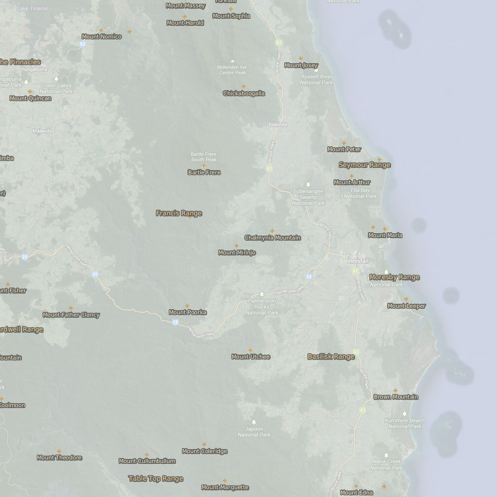
This dataset contains point features depicting mountains, peaks, mountain ranges and hills and their names. Ranges are located with a point or series of points in the approximate vicinity of the feature. Mountain data originated from 1:250,000 scale AUSLIG supplied topographic data (repromats). Corrections were made to locate the points accurately to the 1:100,000 scale National Topographic Map Series. Georeferenced Topographic Maps are dated 1966. This dataset consists of a 90 KB point shapefile containing 344 features. 95% of points within the Mountains coverage were located to the 1:100,000 scale Topographic maps Series. Some smaller hills, mountains and ranges shown on the 1:100,000 scale Topographic map Series, not in the original source data, have not been included in this dataset. 90% of the points are within +/- 50 metres of true position. Data reproduced with permission of Wet Tropics Management Authority This metadata was prepared for the eAtlas and is not authoritative. Please contact the Wet Tropics Management Authority for an authoritative record.